
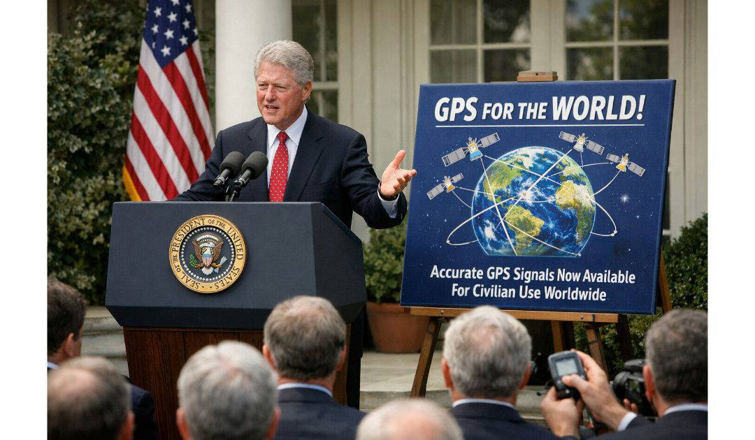
We take GPS for granted now, don’t we? I haven’t used a paper map in the car for, probably, decades? We have paper charts on our boat for planning purposes, but Admiralty charts are no longer available to purchase in paper form. It was on the 2nd of May, 2000, that President Bill Clinton announced that accurate GPS would no longer be restricted to the United States Military.
The Global Positioning System (GPS) is one of the most transformative technologies of the modern age, quietly underpinning navigation, communications, finance, agriculture, emergency services, and everyday smartphone use. Originally developed for military purposes during the Cold War, it evolved into a global public utility that reshaped civilian life across the world.
GPS grew out of the strategic rivalry between the United States and the Soviet Union. In 1957, the Soviet launch of Sputnik 1 demonstrated that radio signals from satellites could be tracked from Earth. American scientists noticed that by measuring the Doppler shift of Sputnik’s signal, they could determine its position. The insight worked both ways: if you knew the satellite’s position precisely, you could determine your own location on Earth.
The U.S. Navy soon developed the Transit system in the 1960s for submarine navigation. While effective, Transit required users to wait for satellites to pass overhead and did not provide continuous coverage. Meanwhile, the U.S. Air Force pursued a more ambitious, all-weather, continuous global navigation system. These parallel efforts were unified in 1973 into what became the Navstar GPS program.
The system was designed to provide highly accurate positioning for U.S. forces anywhere in the world. The first GPS satellite was launched in 1978, and by 1995 the full constellation of 24 operational satellites was complete, providing global coverage.
GPS relies on a constellation of satellites orbiting approximately 20,200 kilometers above Earth. Each satellite continuously broadcasts a radio signal containing two key pieces of information: its precise orbital position and a highly accurate time stamp generated by onboard atomic clocks.
A GPS receiver—whether in a car, aircraft, ship, or smartphone—picks up signals from multiple satellites. By calculating how long each signal took to arrive (based on the difference between the satellite’s timestamp and the receiver’s clock), the receiver determines its distance from each satellite. This process is called trilateration.
To determine a three-dimensional position (latitude, longitude, and altitude), a receiver needs signals from at least four satellites. Three satellites define a point in space; the fourth corrects for any clock error in the receiver. The remarkable accuracy of GPS depends on atomic clocks aboard satellites, which measure time to within billionths of a second. Even a tiny timing error could translate into a large positional error on the ground.
From its inception, GPS had dual uses: military and civilian. However, during the Cold War, the U.S. government intentionally degraded the accuracy of civilian GPS signals through a policy called “Selective Availability.” This introduced small timing errors into publicly accessible signals, limiting civilian accuracy to about 100 meters, while military users with encrypted signals enjoyed far greater precision.
The policy shifted dramatically under Bill Clinton. In May 2000, President Clinton ordered Selective Availability turned off, immediately improving civilian accuracy to around 10–20 meters. This decision unleashed a wave of innovation. GPS rapidly became embedded in consumer devices, aviation systems, shipping logistics, surveying, agriculture, and eventually smartphones.
Since the 1990s, GPS has undergone significant modernization. New generations of satellites broadcast additional signals, improving accuracy, resistance to interference, and reliability. Augmentation systems such as WAAS (Wide Area Augmentation System) enhance precision for aviation and other critical applications. Differential GPS (DGPS) uses ground-based reference stations to correct small errors, enabling centimeter-level accuracy in surveying and precision farming.
Relativistic physics also plays a crucial role. Because satellites orbit at high speeds and experience weaker gravity than clocks on Earth, their atomic clocks tick slightly faster due to effects predicted by Einstein’s theories of special and general relativity. Engineers must correct for these differences; otherwise, errors would accumulate at a rate of several kilometers per day.
While GPS was the first fully operational global satellite navigation system, it is no longer alone. Other nations developed their own systems to ensure strategic independence. Russia operates GLONASS, the European Union developed Galileo, and China built BeiDou. Modern receivers often use signals from multiple systems simultaneously, improving accuracy and redundancy.
Despite this competition, “GPS” has become a generic term in everyday speech for satellite navigation, reflecting the system’s pioneering role and global reach.
Today, GPS supports far more than turn-by-turn driving directions. Financial networks use precise GPS timing to synchronize transactions. Power grids rely on it to coordinate electricity distribution. Emergency responders use it to locate callers. Farmers use GPS-guided tractors to optimize planting and harvesting. Airlines depend on satellite navigation for more efficient routing.
In smartphones, GPS integrates with mapping software and wireless networks to provide real-time location services. Combined with geographic information systems (GIS), it supports urban planning, disaster relief, environmental monitoring, and scientific research.
Despite its strengths, GPS has vulnerabilities. Signals are weak by the time they reach Earth and can be disrupted by interference or deliberate jamming. As reliance grows, protecting satellite navigation systems has become a national security priority. Researchers are also exploring alternatives and backups, such as enhanced inertial navigation and terrestrial timing networks.
Future upgrades aim to increase accuracy to within a meter or less for civilian users worldwide. Continued modernization ensures that GPS remains robust, secure, and adaptable.
From its Cold War origins to its status as a global utility, GPS represents a fusion of advanced physics, aerospace engineering, and policy decisions. What began as a military navigation aid has become an invisible infrastructure supporting the rhythms of modern life—quietly guiding everything from cargo ships to commuters, from financial markets to the smartphone in your pocket.